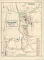
Plan of Sokal
Map of the city and its environs drawn for military uses, detailing all buildings, streets and roads, cemeteries, etc., with an emphasis on showing objects of…
Read more


Map of the city and its environs drawn for military uses, detailing all buildings, streets and roads, cemeteries, etc., with an emphasis on showing objects of…
Read more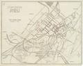
Schematic map of Stryi, circa 1940, showing the city street, road, and railway track network…
Read more