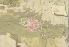
The lower part of the map holds the name: “Situational plan” mentioning Halych (Stadt Halicz) and a list of local names marked with Latin letters.
Below is information on scale (Maasstab von 300 Klafter), measuring line, as well as the year and the author of the drawing (Anno 795. Aufgenohmen ü: gezeichnet durch Major Mahovich des Iplenischen Inf: R).