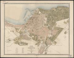
Map of the City of Odesa
- ID: 34572
- Place: Odesa


Hand-drawn Map of the city of Brody with environs, with a detailed depiction of city canals, main roads, buildings, and castle.
No date is provided. Presumably, the map dates to the late eighteenth century.
Legend: