• Menu Close
  • site logo Center for Urban History
Urban Media Archive
News [unarchiving] FAQ About project Contacts
Укр
  • The Center
  • About
    Our History and AimsTeamBuildingCooperationInternshipsNewsMedia and us
  • Events
  • Academic
    ResearchConferences, Workshops, SeminarsUrban SeminarsResidences
  • Digital
    Lviv InteractiveUrban Media ArchiveLviv Streets
  • Public
    ExhibitionsDiscussion Series[unarchiving]Spatial ProjectsDigital StorytellingPublications
  • Educational
    Educational platformSummer SchoolsCourses
  • Library
  • Calendar
  • Store
  • Premises
    Conference RoomAccommodationCafe
  • Contacts
Center for Urban History
6 Bohomoltsia Str. Lviv 79005, Ukraine
Tel.: +38-032-275-17-34 E-mail: [email protected]
  • Time

    • Collections
    • Places
scroll top
Images (62) Videos and films (2) Oral stories (255) Maps (5) Documents (0) Collections (20)
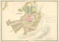
Stanislaw

Stanislaw

  • ID: 34453
  • Place: Ivano-Frankivsk
  • Collection: Austrian War Archive

The plan reflects the state of the city and adjacent territories as of the late eighteenth century.…

Read more
Plan of the City of Stanisławow

Plan of the City of Stanisławow

  • ID: 34450
  • Place: Ivano-Frankivsk
  • Collection: Ryszard Hubisz

The plan shows the limits of the city of Stanisławow (renamed to Ivano-Frankivsk in 1962) with its suburbs, surrounding villages, as well as adjacent…

Read more
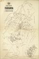
Map of the city of Stanislawow and Knihinin

Map of the city of Stanislawow and Knihinin

  • ID: 34521
  • Place: Ivano-Frankivsk
  • Collection: Science Library of the Ivan Franko National University of Lviv

The map shows the city of Stanislawow, and the territory of the former village of Knihinin, which was subsequently incorporated into the city.…

Read more
Plan of the City of Stanisławow

Plan of the City of Stanisławow

  • ID: 34452
  • Place: Ivano-Frankivsk
  • Collection: Ryszard Hubisz

This map shows the territory of the city of Stanisławow (known from 1962 onwards as Ivano-Frankivsk), with 16 suburban quarters.…

Read more
City Map of Stanislau (Stanisławow)

City Map of Stanislau (Stanisławow)

  • ID: 34460
  • Place: Ivano-Frankivsk
  • Collection: Ryszard Hubisz

German-language map of the city of Ivano-Frankivsk (Stanislawow), circa 1941, made for German military purposes. The map shows main public buildings, chief…

Read more
site logo CENTER FOR URBAN HISTORY
6 Bohomoltsia Str. Lviv 79005, Ukraine
Tel.: +38-032-275-17-34 E-mail: [email protected]
About
Our History and Aims
Team
Building
Cooperation
Internships
News
Media and us
Newsletter
Events
Library
Calendar
Store
Contacts
Academic
Research
Conferences, workshops, seminars
Urban Seminars
Residences
Digital
Lviv Interactive
Urban Media Archive
Lviv Streets
Public
Exhibitions
Discussion Series
[unarchiving]
Spatial Projects
Digital Storytelling
Publications
Educational
Educational platform
Summer Schools
Courses
Premises
Conference Room
Accommodation
Cafe

Subscribe: