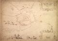
Plan of Leopoliensis
This map is of Lviv’s defensive fortification and surrounding area created in 1635 by Fridericum Getkan, Royal Engineer Metatore.…
Read more


This map is of Lviv’s defensive fortification and surrounding area created in 1635 by Fridericum Getkan, Royal Engineer Metatore.…
Read more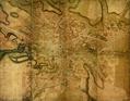
One of the first full scale maps of Lviv created by the Commission of Order under the leadership of Geometer-Architect Jan du Defi in 1766.…
Read more