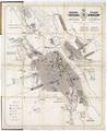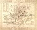
Map of the Village of Janow
Hand-drawn map of Janow (now Ivano-Frankove) and environs, 1850.…
Read more


Hand-drawn map of Janow (now Ivano-Frankove) and environs, 1850.…
Read more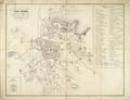
This plan shows the city’s reconstruction in the 18th century; it was created by Maurycy Hr. Dzieduszycki.…
Read more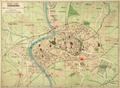
New map of Krakow, 1914, drawn using the “Pharusa” method.…
Read more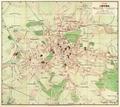
This map of Lviv from 1911 was published by the Polish bookstore owned by B. Poloneczki in Lviv.…
Read more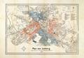
This map of the city of Lviv, published in 1873 by the F. H. Richter bookstore, contains renamed streets.…
Read more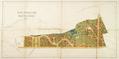
Development project for Kastelivka which was located between Kzhyzhova and Vuletska Streets. According to the project 64 villas were to be built in this area…
Read more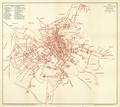
Schematic map of the Royal Capital City of Lviv from 1907 with the most important structures identified.…
Read more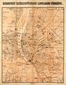
Most Current Map of the City of Budapest, 1908, showing main streets, buildings, and city districts.…
Read more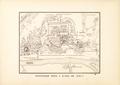
Copy of a map of Kyiv drawn in 1695. In 1884 D. M. Strukov created a copy of the original for the Kiev Archeographic Commission; in 1893 this copy (along with…
Read more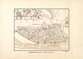
Copy of a map of Kyiv drawn in 1695. In 1884 D. M. Strukov created a copy of the original for the Kiev Archeographic Commission; in 1893 this copy (along with…
Read more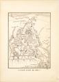
Copy of a map of Kyiv drawn in 1695. In 1884 D. M. Strukov created a copy of the original for the Kiev Archeographic Commission; in 1893 this copy (along with…
Read more
Map of Lviv from 1878 published by the Viennese company Artaria and Co. The map contains the elevation of the highest spots in the city. In the southern part…
Read more