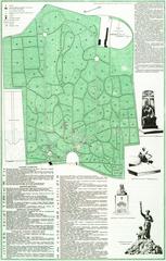
Lychakiv Cemetery. Scheme
- ID: 34568
- Place: Lviv


The present plan shows part of the city territory with suburbs. The southern part of the city is least represented, because the plan's author decided to display the borderlands of the Austrian and the Russian Empires instead of the suburban territories.
The mapsheet exhibits no date of publication. With some exceptions, the graphic execution of the plan reflects the city's urban construction of the early 1860s. The presence of the House of Invalids on the plan permits us to date the plan to no later than 1863.
Czerner attributes the map to Carl Kummerer (Carl Kummerer Ritter von Kummersberg) [18], c. 175. In 1855, Kummerer published the "Administrative Map of the Kingdoms of Galicia and Lodomeria…" (Administrativ-Karte von den Königreichen Galizien und Lodomerien mit dem Großherzogthume Krakau und den Herzogthümern Auschwitz, Zator und Bukowina) in Vienna. Sheet No. 24 of this map held a plan of Lemberg.
The plan was printed and multiplied by the Artaria & Co. Publishers in Vienna (Artaria & Compagnie). The firm specialized in publishing and trade in three areas: arts, music and cartography. The company was founded in 1770 in Vienna, by the Italian Giovanni Artarias. In 1775, the company's premises were situated at 9, Kohlmarktin Vienna. [28] s. 30-31.
In 1920 the Artaria Map Division became part of the Cartographical Establishment of G. Freytag & Berndt (Kartographische Anstalt G. Freytag & Berndt). In 1944 the company was renamed "Freytag-Berndt u. Artaria KG". The company still exists today.
Legend:
Characterization of the map:
Map's toponymics:
The toponymics include appr. 230 objects. All names are inscribed directly on the plan, next to corresponding objects.
List of publications that include the present map:
Inconsistencies and inaccuracies on the map:
Characterization of the city:
The plan reflects the urban space of the early 1860s. Among the most important urbanistic changes from the mid-1850s were construction of the Citadel (1852-1854), construction of the railway station, and establishment of a railway connection between Lviv and Cracow (1861), construction of the Invalids' House, and laying of the surrounding park (1855-1863).
The population of the city was 76,398 as of 1863. Population figures reached the 70 thousand mark sometime in 1857 [20], p. 114.
As of 1855, the city had 2,734 buildings. Urban development was marked by intensive construction from the late 1840s onwards, with many multi-storeyed buildings constructed, and many buildings renovated. Construction activity slowed down over the period from 1851 to the late 1860s. [20], p. 31.
Entry by: Serhii Tereshchenko Translated by: Pavlo Hrytsak