Capital City Lemberg
- ID: 34493
- Place: Lviv


Map of Chernivtsi, 1880, with suburbs and part of the border area of Moldova.
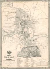
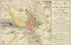
This map is an expanded re-edition of the city map, that was published together with Kummersberg’s topographical map (Sheet No. 59) in 1855-1863 (Kummerer Carl Ritter von Kummersberg. Administrative-Karte von den Königreichen Galizien und Lodomerien mit dem Großherzogthume Krakau und den Herzogthümern Auschwitz, Zator und Bukowina in 60 Bllättern). In addition to Chernivtsi, the sheets of Kummersberg’s map also contain maps of Krakow and Lwow.
The map’s edition and printing was performed by Artaria & Co. Publishers in Vienna.
Legend: