Capital City Lemberg
- ID: 34493
- Place: Lviv


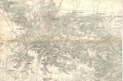
Map of Zaliszczyky (Zaleszczyk) and environs, circa 1855, prepared by the 4th Army HQ. The map shows a project for fortifying territories around the city.
The map was prepared in 1854-1855.
Legend: