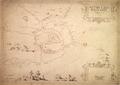
Plan of Leopoliensis
This map is of Lviv’s defensive fortification and surrounding area created in 1635 by Fridericum Getkan, Royal Engineer Metatore.…
Read more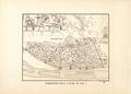
Podil District of Kiev in 1695
Copy of a map of Kyiv drawn in 1695. In 1884 D. M. Strukov created a copy of the original for the Kiev Archeographic Commission; in 1893 this copy (along with…
Read more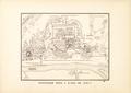
Pechersk District of Kiev in 1695
Copy of a map of Kyiv drawn in 1695. In 1884 D. M. Strukov created a copy of the original for the Kiev Archeographic Commission; in 1893 this copy (along with…
Read more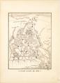
Old Kyiv in 1695
Copy of a map of Kyiv drawn in 1695. In 1884 D. M. Strukov created a copy of the original for the Kiev Archeographic Commission; in 1893 this copy (along with…
Read more
Plan of the city, castles and city suburbs
One of the first full scale maps of Lviv created by the Commission of Order under the leadership of Geometer-Architect Jan du Defi in 1766.…
Read more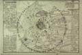
Leopol City Plan the Capital of Red Russ with Neighbouring Towns
The plan is a schematic depiction of Lviv and its environs. It shows the condition of city construction with the contemporary fortifications of the central…
Read more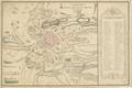
Topography of Leopolis City with Surrounding Subburbs
The map is a schematic depiction of the city and its environs, drawn by Cadet Jean Doetsch in 1770, on the basis of his observations of the city.…
Read more
Capital City Lemberg
This is a hand drawn map of Lviv’s city center from 1777. It is one of the first maps of the city from when the city was under Austrian rule.…
Read more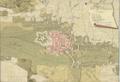
Brody City Plan with the Castle
Hand-drawn Map of the city of Brody with environs, with a detailed depiction of city canals, main roads, buildings, and castle.…
Read more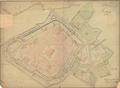
Plan of Lemberg
This is a map of Lviv dated 23 March 1780 signed by the engineer Anton v. Pinterhoffen.…
Read more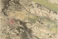
Lemberg Leopol Lwow
This map of Lviv is a part of the Map of the Kingdom of Galicia and Lodomeria (Karte des Koenigreiches Galizien und Lodomerien) was created in 1779-1782 for…
Read more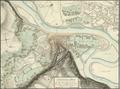
Situation Plan (of Halicz)
Hand-drawn map of Halych and environs as of 1795.…
Read more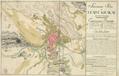
Situational Map of the City of Krakau and its Suburbs
Map of the City of Kraków with its Suburbs: Stradom, Kleparz, Kazimierz, Jewish District (Judenstadt) and Podgórze.…
Read more