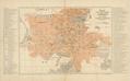
Map of the Royal and Capital City of Lwow
This map was published in 1902 as an appendix to Guidebook to Lviv compiled by F. Baranskyy. Lithographic printing was done by Piller Lithography, Lviv” (Lit.…
Read more
This map was published in 1902 as an appendix to Guidebook to Lviv compiled by F. Baranskyy. Lithographic printing was done by Piller Lithography, Lviv” (Lit.…
Read more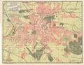
A Ukrainian language map of Lviv from the beginning of the 20th century.…
Read more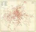
Schematic map of the Royal Capital City of Lviv from 1907 with the most important structures identified.…
Read more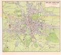
This map shows electric trolley and railroad tracks in Lviv; it was ordered by the Association for Popularizing Foreign Travel in Galicia (Krakow). The map was…
Read more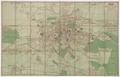
Map of Greater Lviv 1910 with trolley routes and rail road stations.…
Read more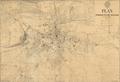
This map is the second edition of a map of the Royal Capital City of Lviv from 1910. Wladyslaw Gabriel (Władyslał Gabriel) prepared this map for print on the…
Read more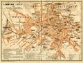
This map of Lviv shows the network of streets and squares and important buildings.…
Read more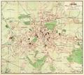
This map of Lviv from 1911 was published by the Polish bookstore owned by B. Poloneczki in Lviv.…
Read more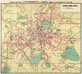
This is a map of Lviv from 1915 was printed by the bookstore Hubrynovych and Son in Lviv.…
Read more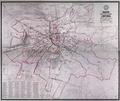
A map of the city of Lviv from 1917 with districts and neighbourhoods demarcated.…
Read more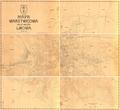
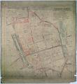
This map shows a plan, created by the Measurement-Regulation Section of the City’s Technical Department, to regulate [building in] the city center; it was…
Read more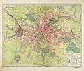
On this map the six districts of Lviv are demarcated along with the outlying areas of Kleparіv, Zamarstynіv, Znesinnja, parts of Kryvchytsi, Kozelnyky…
Read more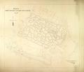
This map is of the Lychakivskyi Cemetery created by the Technical Department in 1924. The sectors are numbered (1-76) and the area around the cemetery is…
Read more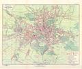
On this map of Lviv from 1925, Lviv’s six districts are demarcated along with the suburbs of Kleparov, Zamarstynov, Znesinnya, parts of Kryvchytsi, Kozelnyky…
Read more